


SPRINGFIELD 1 Voting District, Sangamon County, Illinois
About
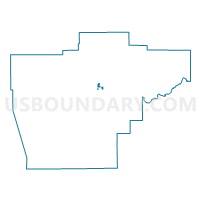
Outline

Summary
| Unique Area Identifier | 574538 |
| Name | SPRINGFIELD 1 Voting District |
| County | Sangamon County |
| State | Illinois |
| Area (square miles) | 0.26 |
| Land Area (square miles) | 0.26 |
| Water Area (square miles) | 0.00 |
| % of Land Area | 100.00 |
| % of Water Area | 0.00 |
| Latitude of the Internal Point | 39.79779290 |
| Longtitude of the Internal Point | -89.61092830 |
Maps


Graphs
Select a template below for downloading or customizing gragh for SPRINGFIELD 1 Voting District, Sangamon County, Illinois


Neighbors
Neighoring Voting District (by Name) Neighboring Voting District on the Map
- CLEAR LAKE 2 Voting District, Sangamon County, IL
- SPRINGFIELD 2 Voting District, Sangamon County, IL
- SPRINGFIELD 3 Voting District, Sangamon County, IL
- SPRINGFIELD CITY 118 Voting District, Sangamon County, IL
- SPRINGFIELD CITY 119 Voting District, Sangamon County, IL
- SPRINGFIELD CITY 48 Voting District, Sangamon County, IL
- SPRINGFIELD CITY 73 Voting District, Sangamon County, IL
- SPRINGFIELD CITY 74 Voting District, Sangamon County, IL
- SPRINGFIELD CITY 78 Voting District, Sangamon County, IL
- WOODSIDE 5 Voting District, Sangamon County, IL
Top 10 Neighboring County Subdivision (by Population) Neighboring County Subdivision on the Map
- Capital township, Sangamon County, IL (115,756)
- Woodside township, Sangamon County, IL (11,447)
- Clear Lake township, Sangamon County, IL (8,527)
- Springfield township, Sangamon County, IL (6,245)
Top 10 Neighboring Place (by Population) Neighboring Place on the Map
Top 10 Neighboring Unified School District (by Population) Neighboring Unified School District on the Map
Top 10 Neighboring State Legislative District Lower Chamber (by Population) Neighboring State Legislative District Lower Chamber on the Map
Top 10 Neighboring State Legislative District Upper Chamber (by Population) Neighboring State Legislative District Upper Chamber on the Map
Top 10 Neighboring 111th Congressional District (by Population) Neighboring 111th Congressional District on the Map
Top 10 Neighboring Census Tract (by Population) Neighboring Census Tract on the Map
- Census Tract 6, Sangamon County, IL (5,233)
- Census Tract 39.02, Sangamon County, IL (3,829)
- Census Tract 24, Sangamon County, IL (3,582)
- Census Tract 16, Sangamon County, IL (3,477)